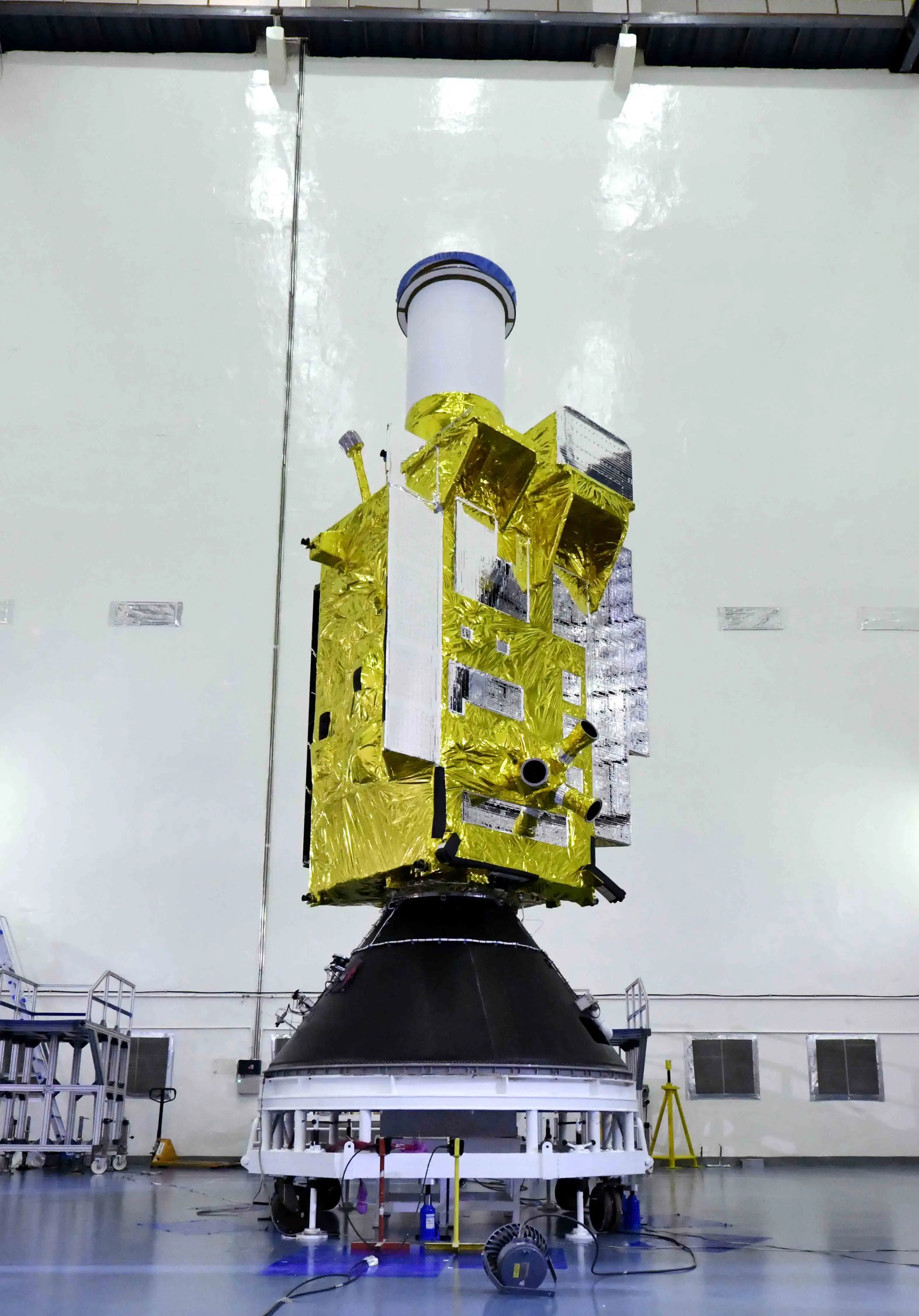
India has launched EOS-05, an Earth-observation spacecraft that ISRO describes as the country’s first imaging satellite for geosynchronous orbit.
The launch took place aboard GSLV-F17 from the Second Launch Pad at the Satish Dhawan Space Centre in Sriharikota. ISRO says the mission was successful and that the launch vehicle placed EOS-05 into the intended sub-geosynchronous transfer orbit.
That wording matters. EOS-05 is not simply another camera in low Earth orbit. Its mission architecture is intended to place an imaging spacecraft much farther from Earth, in a class of orbit that can remain aligned with the same broad region as Earth rotates.
What ISRO has confirmed
ISRO’s mission page and mission brochure establish the central facts:
- GSLV-F17 was the 19th flight of India’s Geosynchronous Satellite Launch Vehicle.
- EOS-05 is an Earth-observation spacecraft.
- ISRO describes it as India’s first ever imaging satellite from geosynchronous orbit.
- The spacecraft mass is listed at approximately 2,367 kg.
- GSLV-F17 placed the spacecraft into a sub-geosynchronous transfer orbit rather than directly into its final operational orbit.
- The nominal transfer orbit in ISRO’s brochure has a perigee of 170 km, an apogee of 28,934 km, and an inclination of 19.28 degrees.
The launcher itself is a three-stage vehicle about 51.7 metres tall with a lift-off mass of about 420.5 tonnes, according to ISRO.
Why geosynchronous imaging is different
Most Earth-observation satellites operate much closer to Earth. A spacecraft in low Earth orbit can obtain detailed observations because it is relatively near the surface, but it also moves rapidly across the planet. A low-orbiting satellite therefore sees a location during a pass and then moves on.
A geosynchronous orbit follows a different logic.
A satellite in a geosynchronous orbit has an orbital period matched to Earth’s rotation. In the special case of a geostationary orbit — circular, above the equator and moving in the same direction as Earth’s rotation — the spacecraft appears to remain fixed above one longitude.
The European Space Agency describes the standard geostationary altitude as about 35,786 km above Earth’s equator. From that distance, a satellite can continuously view a very large part of Earth rather than repeatedly sweeping over narrow strips of terrain.
This is why geostationary spacecraft are familiar in weather monitoring and communications. The same geometry can also be useful for imaging when the priority is frequent observation of a broad region rather than the closest possible view of a small area.
EOS-05 is significant because ISRO is applying that geometry to an Indian imaging mission.
Why the launch vehicle did not put EOS-05 straight into its final orbit
ISRO says GSLV-F17 placed EOS-05 into a sub-geosynchronous transfer orbit.
A transfer orbit is an intermediate path. Instead of using the launch vehicle to carry a spacecraft all the way into a circular geosynchronous orbit, the rocket can release it into an elongated orbit. The spacecraft can then use its own propulsion to reshape and raise that orbit.
This is standard orbital mechanics for high-altitude missions. ESA describes a conventional geostationary transfer orbit as an ellipse in which the satellite later fires its own engine near the high point of the orbit to circularise its path.
EOS-05’s published injection orbit is notably below the standard geostationary altitude at apogee: ISRO gives a nominal apogee of 28,934 km, while the standard geostationary altitude is about 35,786 km. ISRO therefore calls the injected trajectory sub-GTO.
The successful rocket launch is consequently one part of the mission. The spacecraft must still perform the orbital manoeuvres and commissioning steps required before it can begin operational imaging.
What we do not yet know from the public mission material
The primary ISRO material currently available is concise. It identifies EOS-05 as a state-of-the-art Earth-observation spacecraft and establishes its orbital role, but it does not yet provide a detailed public specification of the imaging payload on the mission page or brochure.
That means several questions should remain open until ISRO publishes further first-hand documentation, including:
- the imaging sensor or sensor combination used on EOS-05;
- spatial resolution;
- spectral bands;
- imaging cadence;
- exact operational longitude or orbital configuration;
- detailed civilian applications and data-access arrangements.
It would be premature to assign specific capabilities to EOS-05 merely because other geostationary Earth-observation satellites can perform them.
The larger significance
The key development is not only that India launched another Earth-observation satellite. It is that ISRO has now launched an imaging spacecraft intended for a fundamentally different observing geometry from the low-orbit systems more commonly associated with detailed Earth imagery.
Low Earth orbit and geosynchronous orbit solve different problems. Being closer can improve the achievable detail for a given optical system. Being much farther away can provide persistent visibility of a very large region. Satellite design is therefore a trade-off between resolution, coverage, revisit frequency, instrument size, communications, power and orbital constraints.
EOS-05 gives India a new position within that trade space.
For now, the most defensible conclusion is also the simplest: the launch succeeded, EOS-05 reached its intended transfer orbit, and ISRO has begun India’s first mission to operate an imaging satellite from geosynchronous orbit. The more interesting questions — exactly what it can see, how often it can image, and how its data will be used — depend on technical details that ISRO has not yet fully released publicly.