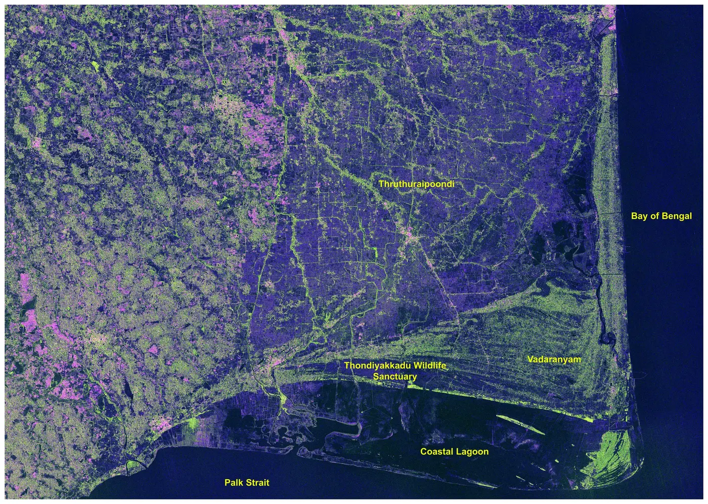
Researchers and other registered users can now download NISAR S-band synthetic-aperture radar data products through ISRO's Bhoonidhi Earth-observation portal.
ISRO announced the release on 24 July. The data include S-band observations over the Indian landmass and selected global locations, with operational products from NISAR Cycle 25 onward being generated for direct distribution.
This is more than an image release. The files include Level-1 and Level-2 scientific radar products that can be used for quantitative analysis of land, water, vegetation, ice and surface change.
What NISAR is
NISAR is a joint NASA-ISRO Earth-observation mission carrying both L-band and S-band synthetic-aperture radar.
Unlike an optical camera, radar sends microwave signals toward Earth's surface and measures the returning signal. Because the measurement does not depend on sunlight and can penetrate clouds, synthetic-aperture radar is particularly useful for observing regions during monsoon conditions, at night or through persistent cloud cover.
NISAR operates in a roughly 747-kilometre Sun-synchronous orbit. ISRO says the mission combines a swath of about 240 kilometres with high-resolution observations and a 12-day repeat cycle.
What ISRO has released
The S-band release includes several product families.
Standard products include radar single-look complex data and geocoded products. Interferometric products allow comparison between radar observations taken at different times. Offset products can be used to estimate displacement between acquisitions.
Those are not interchangeable datasets. A geocoded covariance product, for example, is useful for analysing how surfaces scatter radar energy, while interferometric products are designed for detecting changes in phase that can correspond to surface motion.
Why this matters for India
ISRO's examples illustrate the practical value of the dataset.
A July observation over Nagapattinam district in Tamil Nadu distinguishes vegetation, wetlands, coastal lagoons and water bodies through differences in radar backscatter. Another scene over the Brahmaputra basin separates river channels, floodplains, vegetation and built-up features using polarimetric decomposition.
These capabilities are relevant to flood mapping, agriculture, coastal monitoring, wetland assessment and geohazard analysis.
The key advantage is repeatability. A single radar image describes surface scattering at one moment. A time series can reveal how that surface changes.
Calibration and limitations
ISRO says the current release uses Product Baseline version 1.4.0 and includes radiometric, geometric and polarimetric calibration derived from in-flight calibration and validation work.
The agency also explicitly notes remaining limitations. Users may see residual radiometric banding in low-signal areas such as oceans and deserts, and some radio-frequency-interference artefacts may remain despite mitigation.
That disclosure is important because calibrated scientific products are still not perfect measurements. Processing baselines can improve over time, and historical data may be reprocessed as algorithms are refined.
How users can access it
The products are distributed through Bhoonidhi, ISRO's Earth-observation data dissemination system. Registered users can search by area, acquisition period and product type. ISRO also says programmatic access is supported through an API for authorised users.
The portal includes utilities for converting NISAR HDF5 data to GeoTIFF and Cloud-Optimized GeoTIFF and a QGIS-integrated tool for polarimetric analysis.
Why the release is significant
NISAR's scientific value depends not only on collecting radar measurements but on making consistently processed observations available over time.
The S-band release marks the point at which a large part of that observing system becomes directly usable by researchers and applications teams rather than remaining only a spacecraft capability.
Primary source
- Indian Space Research Organisation. NISAR S-Band SAR Data Products Release. 24 July 2026. https://www.isro.gov.in/NISARS_Band_SAR_Data_Products_Release.html